* Total employment: 195,821
*Wage earners: 86.5 % of total employment
* Unemployed: 33,280 (01/94)
- of which -25: 27.4%
- of which >1year: 36.8%
The territory:
| Road links:
... and soon, the axis Calais/Bayonne
(Rouen - Le Mans - Tours) in 1997 |
From Le Mans by high-speed train:
| The aerodrome:
The aerodrome Le Mans - Arnage offers customised service for business flights:
|
A young population ...
a constant human resource for the strongly expanding higher education
pole : 10,000 students.
| ||
| < 20 years
20 - 59 years
> 59 years Total | 27.4
51.4
21.2 100 | 26.4
53.6
20 100 |
| |
| * Total active population: 229,234
* Total employment: 195,821
*Wage earners: 86.5 % of total employment
* Unemployed: 33,280 (01/94)
|
|
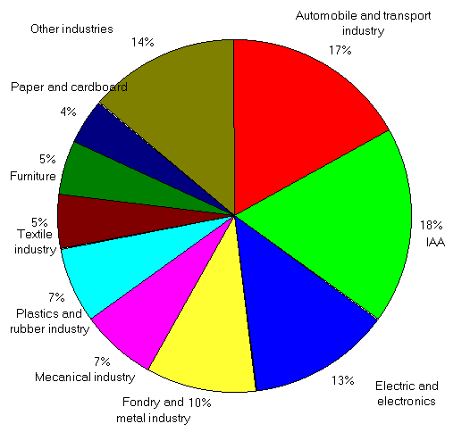
A rationalised agricultural production ...
... directed towards the main sectors of the food industry
(white meats) ...
... and reinforced by the cereal production :
|
|
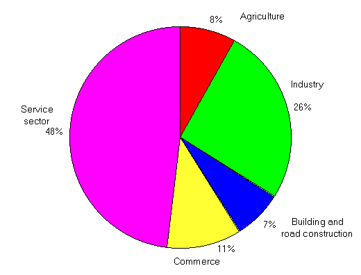
The service industry is developed around two principal poles:
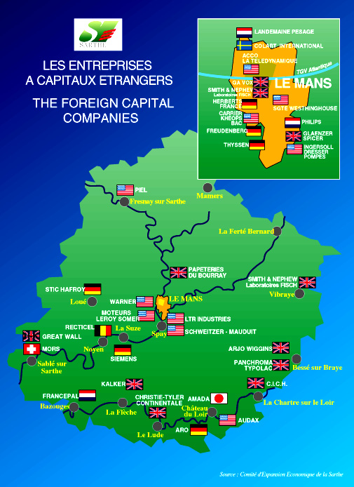
An overview of the foreign capital companies in the Sarthe
 Home Page.